Subject
ContributeAfter Matthew Flinders’s Investigator had followed Spencer Gulf to its limit in 1802, a party attempted to find a route into the northern interior, sighting Mount Arden. While this foray might have sufficiently indicated the arid nature of the interior, the example of other continents suggested more attractive alternative possibilities, such as an inland sea or a great river. These notions drove the early heroic phase of South Australia’s exploration by Europeans.
South Australian Inland Exploration Begins
In 1819 the sealing captain George Sutherland crossed Kangaroo Island by foot, and South Australian inland exploration began in earnest. Charles Sturt’s intrepid riverine explorations (1828–30), in which he discovered the Darling and traced the River Murray to its mouth, not only opened up a large part of fertile south-eastern Australia for settlement but also suggested South Australia’s viability as a new colony. Adelaide’s foundation arose partly through the co by mmencement of the second main phase of Australian exploration. After the Blue Mountains had been crossed in 1813 colonists had begun to consider the sources and destination of the inland rivers of the western plains.
The hinterlands of each colonial capital were quickly traversed by informal, small-scale exploration parties, South Australia being no exception. Routes between Adelaide and the Murray were the first to be investigated – Collet Barker’s 1831 confirmation of an easy route from Gulf St Vincent to the Murray reinforced the decision to locate the capital in its present position. Other hinterland explorations in the period 1836–44, including Johann Menge’s geological investigations in the Barossa Valley and Mount Lofty Ranges and Robert Cock’s numerous forays, proceeded from natural curiosity as to the limits of the colony’s possibilities.
These ventures showed that northern expansion was blocked by environment and climate rather than topography. The aridity of South Australia’s interior caused the colonists to despair of moving beyond their ‘fertile island’. The narrow corridor of the Murray, traversed by overland expeditions led by Joseph Hawdon and Charles Bonney (1838) and Alexander Tolmer, and the fertile South East, investigated along the Coorong by Bonney (1839) and by Governor George Grey (1844), extended the eastern and southern limits of this ‘island’, but the northern obstacle remained.
Edward John Eyre
The overlander Edward John Eyre was the first both to test this northern barrier and to succumb to its persuasive mythology. His 1839 expedition took him to Mount Arden and the Flinders Ranges, from where he encountered the ambiguity of Lake Torrens, an explorers’ nemesis for the following two decades. Travelling via Adelaide to Port Lincoln on Eyre Peninsula he searched for an overland route to the west, penetrating as far as Streaky Bay, then returning via the Gawler Range and Lake Torrens, both of which he named.
In 1840 he led the first official expedition dedicated to the discovery of the interior of Australia. With a small party on horseback Eyre was defeated by various apparent manifestations of Lake Torrens, including Lake Eyre South and mirages to the north of Mount Hopeless. The myth of an encompassing ‘horseshoe lake’ was born, making the northern Flinders Range ‘the termination of the island of South Australia’. Eyre passed within a short distance of mound springs which later proved a crucial stepping stone to the Centre. He retreated and turned west again, combining the search for a passage north with the discovery of an overland route to Perth.
Following this epic expedition marred by violence and tragedy, during which he encountered ‘the most wretched and desolate country imaginable’ (Journals of Expedition and Discovery into Central Australia, p. 127), Eyre returned to Adelaide as a hero. He was convinced that neither an inland sea nor great river existed beyond the northern barrier.
Charles Sturt
A frustrated Adelaide public servant, Charles Sturt rose to Eyre’s challenge, securing British backing for an expedition that would outflank the ‘horseshoe’ obstacle by working up the Murray and Darling to a point of departure. Unlike his riverine explorations, Sturt’s 1844–46 ‘Central Australian expedition’ was relatively cumbersome and military in organisation. It relied on ox teams, large numbers and painstakingly surveyed, incremental progress.
Aboriginal groups along the rivers assisted Sturt through their territories, but the expedition foundered as it left the assured waters of the Murray and Darling, entering trackless territory marked by ephemeral springs and waterholes. Sturt was obliged to create a large base-camp, engaging in heroic forays to the north and north-east during searing heat and drought. Over these months he discovered the Grey Range in western New South Wales, Cooper Creek, the Diamantina and Eyre Creek, the Stony Desert which now bears his name, and the Simpson Desert, which finally put paid to his dream of an inland sea. Sturt’s consequent view of the Centre as an impenetrable wasteland slowed the exploration process.
Further Expeditions in the North
A combination of private and government-sponsored expeditions continued to nibble at the edges of the desert interior. With Edward C. Frome’s 1843 confirmation of the existence of an eastern arm to the ‘horseshoe’ (Lake Frome, in fact), it was not surprising that reconnaissance expeditions by John Samuel Oakden, H.S. Hulkes, John Barton Hack, Charles Christian Dutton and Charles Swinden focused on the region to the west of Lake Torrens, around Lake Gairdner, and to the north of Fowlers Bay. The successful 1843 overland foray from Fowlers Bay to Port Lincoln by two whalers prompted John Charles Darke’s 1844 exploration of northern Eyre Peninsula and the Gawler Ranges, ending in his spearing by Aborigines.
In 1846 John Ainsworth Horrocks’s ambitious attempt to penetrate further north by camel ended in mishap. Then, in a year of high rainfall George Goyder’s 1857 expedition confirmed the Flinders Ranges as the most reliable path into the Centre and, on encountering a flooded Lake Blanche, even raised hopes once more of a viable waterway northwards. Unfortunately the lake had turned to salty mud by the time Arthur Henry Freeling arrived with a boat a year later.
Benjamin Herschel Babbage’s careful but laboured 1857 survey between lakes Gairdner and Torrens added little, until the expectation of his recall spurred him north to discover mound springs and Lake Eyre North. Percy Egerton Warburton, who bore the news of Babbage’s recall in 1858, located additional mound springs and confirmed the separation between lakes Torrens and Eyre. Samuel Parry breached the horseshoe by travelling north from the Flinders Ranges, locating still more mound springs. During the same year, Augustus Gregory (in search of Ludwig Leichhardt) followed the Strzelecki Creek south to Lake Blanche and on to Adelaide. The illusory horseshoe fell apart and the northern frontier was extended to Lake Eyre, but lingering belief in a great inland lake remained.
John McDouall Stuart
Meanwhile John McDouall Stuart had been undertaking exploration forays for the pastoralists James Chambers and William Finke. During 1857, with one white companion and an Aborigine he had discovered the permanent waters of Chambers’ Creek (later Stuart Creek). Then, guided only by his pocket compass, Stuart zig-zagged south to Fowlers Bay, opening up 104,000 square kilometres of country for occupation. In 1860 Stuart discovered the Finke River, opening a route to the Centre. Within weeks he had found and named the MacDonnell Ranges, planted his flag on Central Mount Sturt (almost immediately renamed Central Mount Stuart) and advanced north until his small party turned back near Tennant Creek, threatened by scurvy and Aboriginal attack.
Stuart received tremendous acclaim in South Australia and in Britain for having lifted the ‘veil’ over the interior. The Victorian government entered the race to cross the continent, lavishly equipping the Burke and Wills Expedition, but Stuart had already set off on a second attempt to reach the northern coast. This time he was halted by thick scrub and dwindling supplies in the tropical zone beyond Newcastle Waters. While he re-equipped in Adelaide, Burke and Wills reached the Gulf of Carpentaria and subsequently perished at Cooper Creek. In contrast to Stuart’s carefully determined line of waters (which linked the mound springs of northern South Australia with significant Aboriginal waterholes through the Northern Territory), their route was essentially haphazard and subsequently ignored. Stuart finally reached the northern coast near his objective – the Adelaide River – in July 1862.
The South Australian government immediately recognised his route as the logical corridor across the continent. Stuart’s achievement – filling in the ‘great blank’ of the Centre and giving Australia a ‘front door to the world’ – underpinned South Australia’s successful claim to the Northern Territory and the contract for the overland telegraph line.
Desert Crossings
John McKinlay’s relief expedition, sent from Adelaide to ascertain the fate of Burke and Wills, found Gray’s grave and assumed the party to have been murdered. McKinlay then explored the country between Eyre Creek (the limits of Sturt’s explorations) and Central Mount Stuart, but like Sturt found the Simpson Desert impassable. He made for the northern coast following Burke’s track, and reached the Gulf in May 1862. McKinlay’s explorations linked together those of Gregory, Sturt, Leichhardt, and Burke and Wills but highlighted the impenetrability of the Simpson Desert. Warburton’s 1866 explorations north of Lake Eyre (during which he discovered the major creek bearing his name) further elucidated this region, but it was left to John Lewis in 1874 to circumnavigate Lake Eyre.
With the establishment of a viable north–south corridor, further delineated by the survey expeditions preceding the overland telegraph’s construction, attention was focused upon a route into Western Australia from the Centre. The 1870s expeditions of William Giles, William Gosse and Warburton were each directed towards this end, but only Giles and Gosse contributed to knowledge of South Australia, traversing the Musgrave, Mann and Tomkinson ranges. Giles’s epic double crossing to Western Australia from Beltana following a route of springs across the Nullarbor and Great Victoria Deserts during 1875 relied upon Aboriginal knowledge.
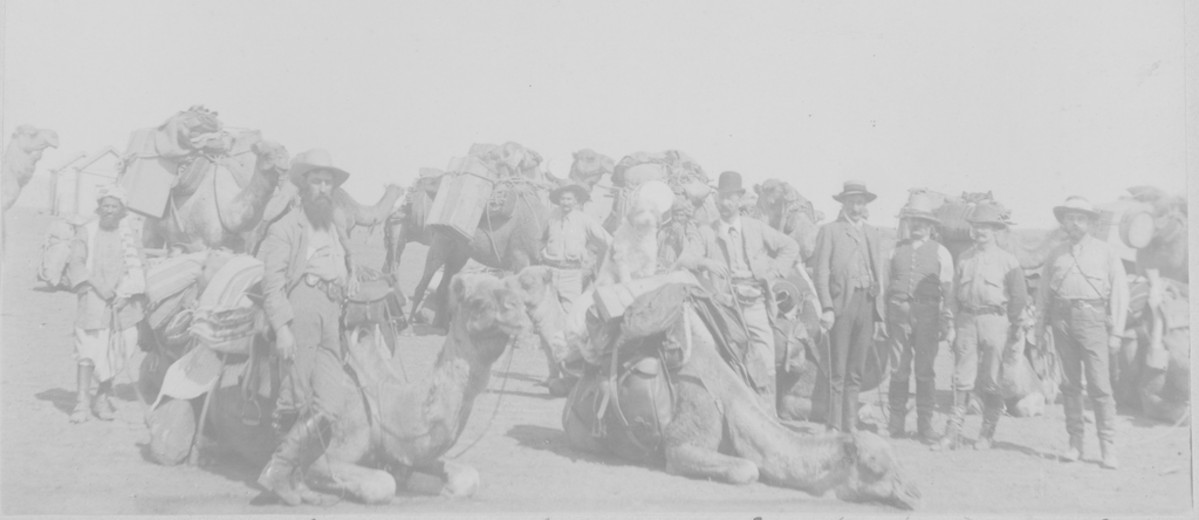
In the 1880s a number of government surveyors – particularly David Lindsay, William Cornish, James Jones and Samuel G. Hübbe – filled in much of the detail of South Australian exploration. While Cecil Madigan’s 1939 crossing of the Simpson Desert is more widely known, David Lindsay’s 1886 camel expedition to the heart of the desert, relying upon Aboriginal knowledge of mikari wells, was the first to show that this forbidding country was also a familiar and ancient home to Aboriginal people.
European exploration of South Australia was effectively complete by the time Lindsay led the Elder Scientific Exploration Expedition of 1891–92, which aimed to open a viable route from the northern railway terminus (then advancing towards Oodnadatta) to north-western Australia. The expedition, the first to pass through the Everard Ranges, crossed the Great Victoria Desert. A decade later the independent explorer Richard Threlwell Maurice began a series of expeditions north from his home at Fowlers Bay, relying on Aboriginal guides to map springs and waterholes throughout north-western South Australia.
In the course of a century then, the main features of South Australian territory had been investigated and mapped.
Media
Add mediaImages

Image courtesy of the State Library of South Australia, SLSA: B 6289, Public Domain

Image courtesy of the State Library of South Australia, SLSA: B 10340, Public Domain

Image courtesy of the State Library of South Australia, SLSA: B 6125, Public Domain

Image courtesy of the State Library of South Australia, SLSA: B 1360, Public Domain

Image courtesy of the State Library of South Australia, SLSA: B 67/22/24, Public Domain

Image courtesy of the State Library of South Australia, SLSA: B 34142/1, Public Domain

Image courtesy of the State Library of South Australia, SLSA: B 6847, Public Domain

Image courtesy of the State Library of South Australia, SLSA: B 6693, Public Domain


CommentAdd new comment
Quickly, it's still quiet here; be the first to have your say!