1. Book Plan of South Adelaide

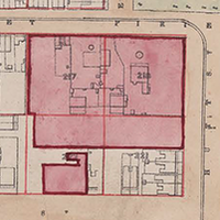
    Book Plan of South Adelaide. Courtesy of the State Library of South Australia, SLSA: B1578746 

    Prior to the development of the suburbs of Adelaide, ‘South Adelaide’ was the name given to the city area bordered by North, South, East and West Terraces. ‘South Adelaide’ was distinguished from ‘North Adelaide’, located across the River Torrens. 

    Maps and Panoramas | By Jude Elton, History Trust of South Australia | 1880s

  2. Duryea Panorama

    Panorama of Adelaide, 1865. Photographer: Townsend Duryea. Courtesy of the State Library of South Australia, SLSA: B5099

    Maps and Panoramas | By Kate Walsh | 1860s

  3. Henley-on-Torrens Regatta

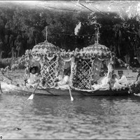
    In 1910 thousands of people lined the Torrens to see the carnival of lavishly decorated boats in the first Henley-on-Torrens Regatta

    Historical Event | By Corinne Ball, Migration Museum | Parklands, River Torrens | 1910s, 1920s, 1930s, 1940s, 1950s, 1960s, 1970s, 1980s, 1990s, 2000-2010, 2010s

  4. Kingston Map

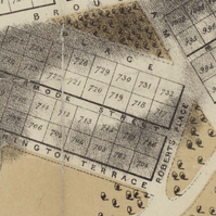
    The Kingston Map of Adelaide of shows building development and the variety of construction just six years after colonial occupation of the site.

    Maps and Panoramas | By Jude Elton, History Trust of South Australia | 1840s

  5. Light’s Plan of Adelaide, 1840

    Light’s Plan of Adelaide as printed in 1840 gives the names of people who first bought land in the city and the title numbers of the town acres that they purchased.

    Maps and Panoramas | By Jude Elton, History Trust of South Australia | 1830s, 1840s

  6. The Great Stuart Demonstration

    'A red letter day in the calendar of South Australia': welcoming home heroes

    Historical Event | By Mandy Paul, History Trust of South Australia | 1860s