1. Book Plan of South Adelaide

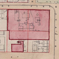
    Book Plan of South Adelaide. Courtesy of the State Library of South Australia, SLSA: B1578746 

    Prior to the development of the suburbs of Adelaide, ‘South Adelaide’ was the name given to the city area bordered by North, South, East and West Terraces. ‘South Adelaide’ was distinguished from ‘North Adelaide’, located across the River Torrens. 

    Maps and Panoramas | By Jude Elton, History Trust of South Australia | 1880s

  2. Light’s Plan of Adelaide, 1840

    Light’s Plan of Adelaide as printed in 1840 gives the names of people who first bought land in the city and the title numbers of the town acres that they purchased.

    Maps and Panoramas | By Jude Elton, History Trust of South Australia | 1830s, 1840s